People have best guess when to shift their houses into new location
2023-02-17
Location
Continent:
Asia
Country:
Nepal
Location:
Gobargada
Region:
South Asia
Disaster Characteristics
Disaster Group:
Hydrological
Disaster Type:
Storm
Disaster Sub type:
Flash Flood
Disaster Response
DRR Phase:
Preparedness
Response Category:
Social cultural based
Response Subcategory:
Knowledge-skill
Knowledge attribution
Local people have a deep understanding of the river morphology and erodibility derived from experiences, both individual and collective. It is closely associated with reasoning and forms the basis of intuition. The constant observation of shifts in river channels, volume of water, intensity of cutting is used wisely in finding suitable areas for the next safe venture. Shift of houses to relatively safer zones as the river starts gradually eroding toward villages is a common practice in Gobargada and Shreeland Tappu. Such shifts have been frequent (1-10 places) within a short distance (200 m -2400, but 7600 m in case of major shifts) in the last 50 years.
Description
River channel shifting possesses a significant risk to life and property within the floodplain. But this is not the case in Shrilanka Tappu and Gobargada, where several shifts of human settlement within a few kilometers (in some cases 100-300m) in the last fifty years have been recorded. We found some houses were just within 100 m of the river and locals were confident about their safety, at least for this year. The traditional form of observation is quite strong and reliable that helps locals stay alert in the flooding season. People accept the fact that rivers are always in motion and the experience shows that they change their direction every 10-12 years. Therefore, the community is always prepared for the worst. Their past experience has equipped them well in using the knowledge shared by the elders to monitor the flow pattern of the river. They have been wisely using the knowledge to constantly monitor the flow direction, water current and annual erodibility that gives a tentative idea in terms of occurrence and extent of the disaster each year. They have their own system of confirming the information they gather, then discussing with the other community members to plan further. The people use the knowledge that has been transferred from the previous generations to prepare relocation and resettlement plans. The people residing nearest to the river or the most vulnerable ones are to shift first, hence, they have their own way of maintaining the shifting cycle.
Images
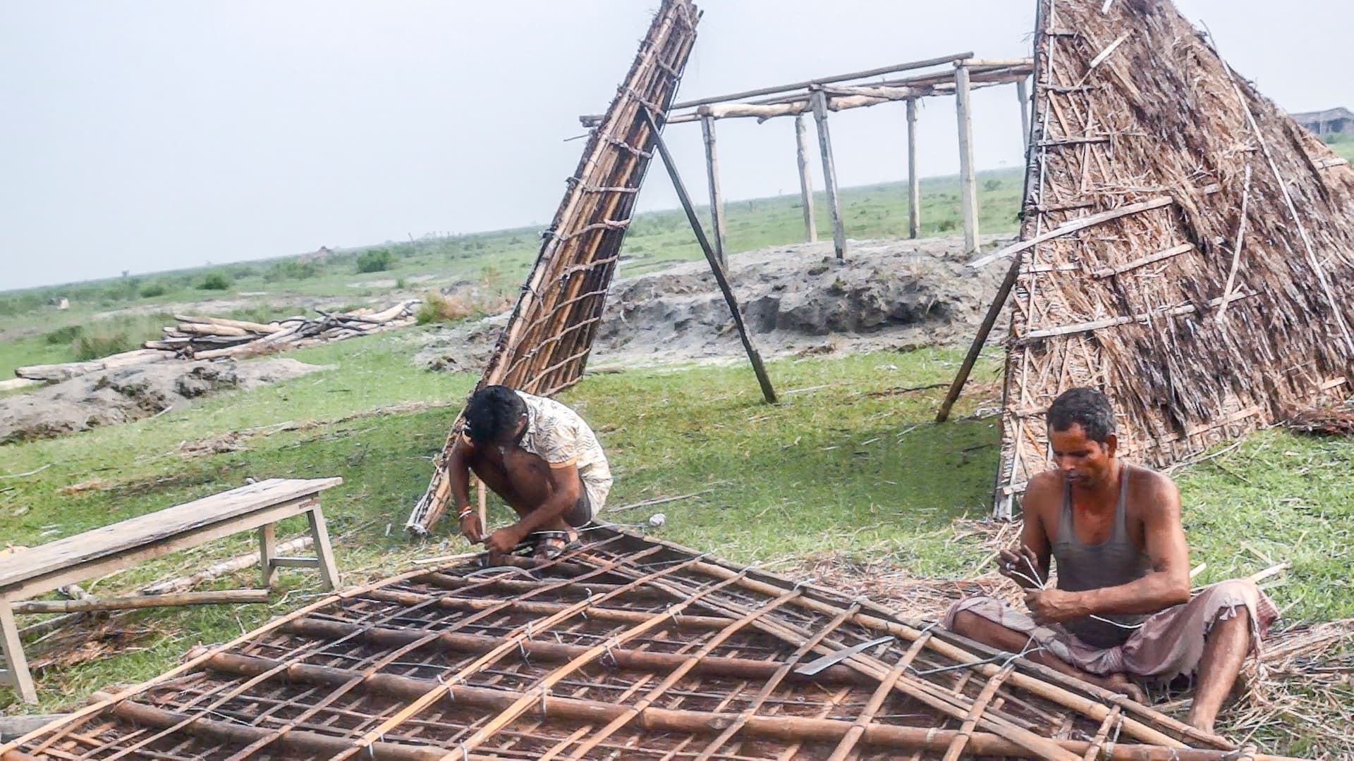
Caption:Locals at Gobargada preparing to shift
Credit:RC Timilsina
Similar:
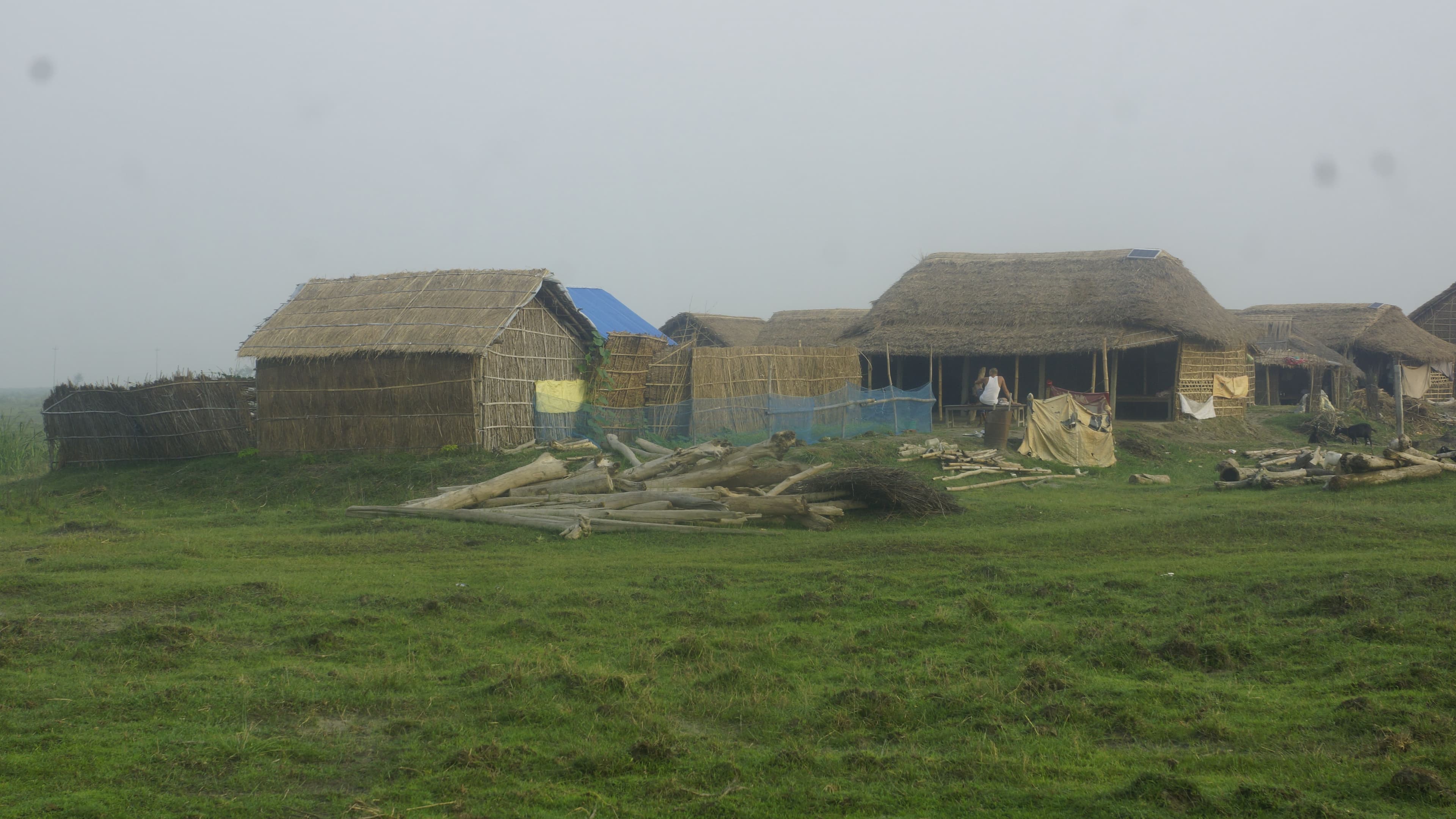
Almost everything is made of local materials, making people the least dependent on outside the world
The village is situated in the floodplain area and surrounded by the Koshi River, one of the largest rivers originating from Himalaya, covering the parts of Nepal and Tibet, China and meanders across Gangetic plain areas of Nepal and India. The river shifts randomly and studies have shown that it has shifted more than 133 km from east to west during the last 200 years. The study area lies just 80 km south of Chure Mountain (Chatara) along Nepal-India border. It is an isolated village situated in the river island formed by the two major tributaries (both branches on either side of the river appear to be the same, making it difficult to identify the main stream). There is no bridge and locals have to take a traditional boat to reach the village in all the seasons. The Koshi has been a problematic river due to massive floods during monsoon season that begins in June and ends in September every year. The flood not only inundated the nearby settlements, but also destroyed cropland by excessive siltation and land cutting/erosion. The village lies south of Koshi Barrage, a huge intervention to control floods and soil erosion that the Government of India completed in 1962. However, flooding and land cutting are common problems. People rely on forests for a variety of items including construction of houses and other essential products. Here forest provides more than 98% resources for construction of houses, fences and other essential materials, which mostly come from three species that are abundant in the area.
People have unique house construction technique, well suited for flood prone situation (foldable and portable house)
Houses are made without using mud, stone or brick. Locals just used locally available materials, such as, Khar, Pater, Bamboo, wood. The construction of the house is very basic and doesn’t take much time either. If they have to relocate to another place, it is quite easy to bring their house by separating different structures and carrying them on a tractor. Moreover, if the flood destroys the house it wouldn't harm them much as it is lighter and can float on the water. The only change that can be seen at present is very few use of concrete pillars while constructing the houses. These pillars are the byproduct of Trikhutti that is used to prevent the flood.